Friday, April 29, 2011

Friday - 4/29/2011
2pm

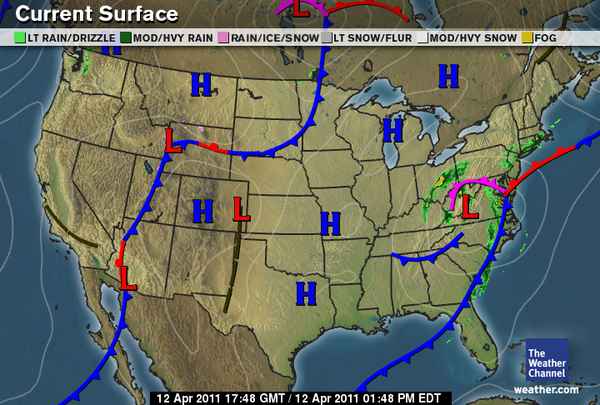
The same weather as the 27th persisted until today the 29th. Today the sky are clear with no cloud cover. temperature have risen to about 18°C. The wind has changed to 12 MPH SW. As we can see in the surface map the high pressure system sitting below Wi is influencing these conditions. It looks like tomorrow(maybe even tonight), cloud cover should return and should produce rain as the low pressure system moves across. It isn't clear what the conditions will be like next week, but hopefully this might be the last of the rain.

Wednesday, April 27, 2011

Wednesday - 04/26/2011
7pm

Over the last week we have had mainly rainy miserable days, with about one day of sunshine. Today has been similar! A little less rain about 10mm since 9am. The wind is currently at 8MPh NW, the temperature today had a high of about 6°C. Barametric pressure is at 1001.9mb and has been flucatuating between about 996-1004mb over the last week. The surface map tells us we should expect similar weather for the rest of the week, with maybe abit of sun on friday. As cloud cover has been overcast everyday when it hasn't been sunny.

Wednesday, April 20, 2011

Wednesday - 04/20/2011

1pm


After finishing my blog for yesturday about 5-10 minutes later sleet started to fall from the sky, which then turned to snow which went through the night and up until about 11:30 when it turned to rain. The current conditions are:

  • Temperature 3.2 Degrees Celsius
  • Wind - Calm
  • Cloud/type - 100% Altostratus
  • Dew Point -1.1 Degrees Celsius
  • Barometric Pressure - 1019mb
  • Precipitate - .09ml
I believe the Colorado Low that we expected didn't have as much energy as first anticipated. There still is alot of moisture in the clouds which are covering the majority of Wi. By the looks of the surface map it seems EC might have a clear day tomorrow or atleast in the afternoon, but will probably have the same conditions as seen today for the Easter weekend.

Tuesday, April 19, 2011

Tuesday - 04/19/2011
3pm

Today was supposed bring rain/snow but as of yet we have seen no sign of either! The current conditions are -
  • Temperature of 5 °C
  • Wind speed 20-23 MPH, NE (So it should be raining)
  • Due Point -7 °C
  •  Barometric pressure 1014.2 mb
Right now I don't understand why the cloud aren't producing precipitate. Stratus clouds fill the sky at 100% cover. The conditions are perfect and there is alot of moisture in the air, so I'm expecting rain anytime soon!

Monday, April 18, 2011

Monday - 04/18/2011
2:00pm

We have cold weather again this week unfortunately. Currently we have a temperature of 8 °C and a dew point of -7°C. Wind is moving 3MPH N, but has also been to the east throughout parts of the day. Cloud cover is at about 65% Cirrostratus cloud., and barometric pressure is sitting at 1014.8mb. The surface map indicated we are in for some 'Sh^tty' weather in the next few days, as a Colorado Low is developing. There is ample cloud cover over the majority of the country which is likely to produce alot of snow/rain with the system. I am forecasting snow (for earlier in the day) and rain (later in the day) for tomorrow as a result of the colorado low.

Friday, April 15, 2011

Friday - 04/15/2011
1pm

Temperatures have dropped today (and yesturday) as the cold front has moved through. The sky is currently filled with about 80% stratus clouds, and barometric pressure is at 1017.7 mb. The current temperature is at 6 °C which is about the high of today. Wind are between 17-28 MPH E, which is putting the windchill at 2 °C. We are likely to see similar temperatures tomorrow and possibly the weekend aswell. Precipitate in the form of rain maybe snow over the weekend if temperatures continue to drop, as we can seee on the surface map there is a high chance of precipitate occuring as the Low pressure system (which has alot of moisture surrounding it) will most likely track NE.

Wednesday, April 13, 2011

Wednesday - 04/13/2011
2:00pm

Today we have fine weather again, though about 80% of the sky is covered by altostratus cloud meaning we should see rain later tonight or in the early morning. Temperature has increased a fraction from yesturday to 17 °C, which may be due to the cloud cover, in the morning though it did feel considerably colder then yesturday. Barometric pressure is the same as yesturday sitting at 1018.7mb which indicates stable weather, if rain is in store for tonight then this should start dropping soon. Wind is at 10MPH NW, if rain does occur later tonight we should see a change to a NE wind later on. There is a cold front crossing the state as we speak, temperatures haven't decreased yet but should tonight/tomorrow. My forecast for tonight is possible rain with tomorrow also having a possibility of rain and closer temperatures.

Tuesday, April 12, 2011

Tuesday - 04/12/2011
1pm

As forecasted we are undergoing similar conditions to yesturday. There are some stratus cloud out at about 70% which is an increase from yesturday. Currently the temperature is 16 °C (exactly the same as yesturday) with dew point at 1 °C. Wind is 9 MPH but is coming from the west. Barometric pressure has risen to 1018.2 mb (a 10mb rise since yesturday) which is bringing stable weather. By the looks of the surface map it seems a cold front is moving in from the west, which will likely reduce temperatures. There is also cloud cover coming with it & a warm front just above it which is also likely to bring precipitate if the system shifts south.

Monday, April 11, 2011

Monday - 04/11/2011
3:20pm
After yesturdays tornado warning, we didn't actually receive any stormy weather here in Eau Claire. At the most we had a slight shower of rain. I believe the same conditions are occuring today, we are undergoing some warm weather through the day which is going to produce thunderstorms in the afternoon/night. Right now the temperature is sitting at 16 °C and the dew point is a 1°C. Wind is between 13-20MPH north and is looking to become calm, so a change in the wind is likely to occur sometime this evening. Barometric pressure has risen to 1008.8mb which is about 15-20mb above yesturday when the tornado warning went out.It looks like tomorrow will produce similar conditions to today, it is hard to tell at this moment but we will have a better idea once the wind changes. Right now the surface map is indicating clear and fine weather tomorrow (in Wi), it will be interesting to see what tomorrows surface map brings for the rest of the week.

Sunday, April 10, 2011

Sunday - 04/1-/2011
4:00pm


After a day of warm weather at about 26°C there is a strong chance of a tornado this afternoon. If not deffinantly a severe storm.As we can see on the surface map a large low pressure system is moving towards the state with a large amount of saturated air hanging off it (the warm front). Currently the barometric pressure is down to 989.4 which is a dramatic drop from earlier today. Warnings are out for the EC area for a tornado watch, so it should be interesting to see what the afternoon brings!

Wednesday, April 6, 2011

Wednesday - 04/06/2011

Todays weather was great, no thanks to my forecast as it was wrong today! Temperature peaked at about 15°C today which was great, wind chill however brought this down to about 8-9°C. Barometric pressure has risen since yesturday to 1011.3 mb, which is proabably why the low pressure system couldn't move in from the west.

Tuesday, April 5, 2011

Tuesday - 04/05/2011
1:30pm

As we can see todays weather is looking good! Minimal cloud cover with a few (about 10%) cirrus clouds about. the current temperature is 8 °C and dew point is at -7 °C. Barometric pressure has risen to 1006.0mb which is only slightly higher then yesturday. Winds are coming from the west at around 9 MPH. As we can see on the surface map minimal cloud is over the state. There is alot of activity on the east coast which is causing the strip of storms from North to South along the cold front as it meets the warmer air off the atlantic. For the coming days it looks like the low pressure systems and clouds are going to move in from the west which is likely to bring precipitate and miserable weather.

Monday, April 4, 2011

Monday - 04/04/2011
1:30pm

Today is miserable! A low pressure system has come in from the west as forecasted and has stuck around all weekend. Currently overcast cloud is above us and has been since sunday, creating isolated showers. Barometric pressure is still low at 1001.3 and has been at this point for about 3-4 days. Temperature is quite high, currently sitting on 6 °C which is mainly due to the high cloud cover, with dew point at -1 °C. Gusts of wind has been blow NW in the vacinity of 14-25 MPH. As we can see the Low above Wi is creating alot of cloud cover so I expect this will keep up for the rest the day with precipitate but should cease tomorrow. It looks like more cloud will move in from the west in the coming days later in the week.

Friday, April 1, 2011

Friday - 04/1/2011
4:30pm

Last night & today we had rain/snow as predicted! All throughout the day has been overcast sky's with drizzle falling lightly. Temperature at the moment is sitting on 3 °C with dew point sitting at 0. Barometric pressure has fallen to 1002.4 which is why this miserable weather is continuing. Wind is currently at 9 MPH, and has been changing W and NW throughout the day. As seen on the surface map we have alot of cloud cover over the state aswell as an occluded front which is causing instability and resulting precipitate. This weather may pass by before tomorrow but it looks like there is more on its way from the west which might hit tomorrow night or saturday.